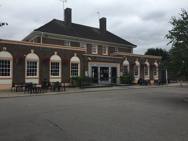
This was an existing pub of the same name, built in the 1950s, in a suburb of Ellesmere Port. The agricultural character of much of the area is represented in the borough coat of arms by a sickle. In fact, where this pub stands seems to have been farmland, until the development of council and private housing here in the post-war years. Planning permission was granted in 1955 and the pub was built soon after. The name of the proposed pub was not recorded on the application.
Text about The Wheatsheaf.
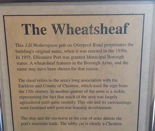
The text reads: This JD Wetherspoon pub on Overpool Road perpetuates the buildings original name, when it was erected in the 1950s. In 1955, Ellesmere Port was granted Municipal Borough status. A wheatsheaf features in the borough arms, and the name may have been chosen for that reason.
The sheaf refers to the areas long association with the Earldom and County of Cheshire, which used the sign from the 13th century. In another quarter of the arms is a sickle, representing the fact that much of the area was largely agricultural until quite recently. This site and its surroundings were farmland until post-war housing development.
The ship and the sea-horse in the coat of arms denote the ports maritime trade. The tabby cat is clearly a Cheshire.
Illustrations and text about Ince.
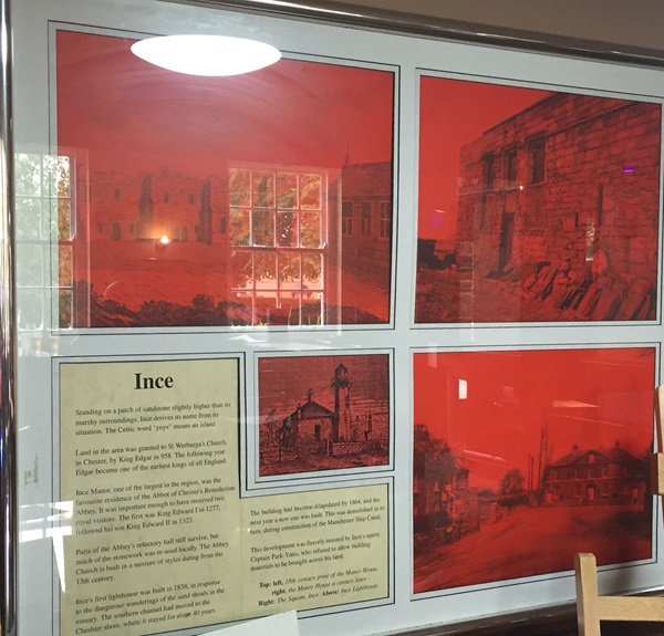
The text reads: Standing on a patch of sandstone slightly higher than its marshy surroundings, Ince derives its name from its situation. The Celtic word ‘ynys’ means an island.
Land in the area was granted to St Werburga’s Church in Chester, by King Edgar in 958. The following year Edgar became one of the earliest kings of all England.
Ince Manor, one of the largest in the region, was the favourite residence of the Abbot of Chester’s Benedictine Abbey. It was important enough to have received two royal visitors. The first was King Edward I in 1277, followed his son King Edward II in 1323.
Parts of the Abbeys refectory hall still survive, but much of the stonework was re-used locally. The Abbey Church is built in a mixture of styles dating from the 13th century.
Ince’s first lighthouse was built in 1838, in response to the dangerous wanderings of the sand shoals in the estuary. The southern channel had moved to the Cheshire shore, where it stayed for some 40 years.
The building had become dilapidated by 1864, and the next year a new one was built. This was demolished in its turn, during construction of the Manchester Ship Canal.
This development was fiercely resisted by Ince’s squire. Captain Park-Yates, who refused to allow building materials to be brought across his land.
Top: left, 18th century print of the Manor House, right, the Manor House a century later.
Right: The Square, Ince
Above: Ince lighthouse.
Prints and text about The Manchester Ship Canal.
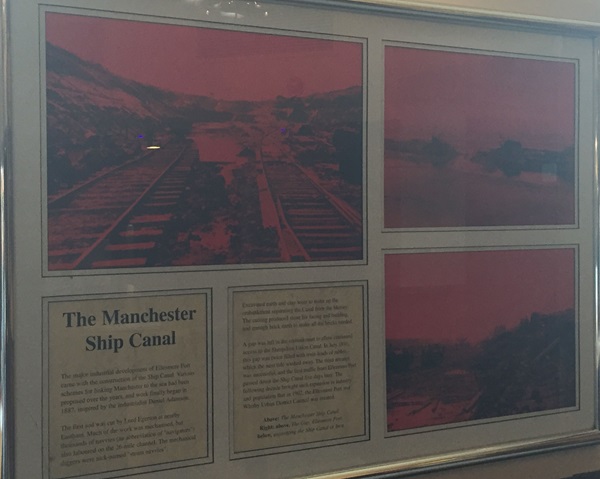
The text reads: The major industrial development of Ellesmere Port came with the construction of the Ship Canal. Various schemes for linking Manchester to the sea had been proposed over the years, and work finally began in 1887, inspired by the industrialist Daniel Adamson.
The first sod was cut by Lord Egerton at nearby Eastham. Much of the work mechanised, but thousands of navvies (an abbreviation of navigators) also laboured on the 26-mile channel. The mechanical diggers were nick-named ‘steam navvies’.
Excavated earth and clay went to make up the embankment separating the canal from the Mersey. The cutting produced stone for facing and building, and enough brick earth to make all the bricks needed.
Above: The Manchester Ship Canal
Right: above, The Gap, Ellesmere port, below, excavating the Ship Canal at Ince.
Prints and text about Hooton Hall.
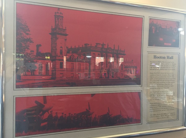
The text reads: Two successive Hooton Halls, the second built in 1778, were the Stanley family seat for over 500 years. Gambling debts forced the sale of the second hall to a Mr Naylor, whose resentment of his rates bill was such that he left the building empty to avoid paying.
During World War I, Hooton Hall was used as a convalescent home for servicemen, while Hooton Park was used as an airfield. Part of the park was used by aircraft manufacturers such as Comper Swift, who produced their 100 mph swift there during the early 1930’s. Later, an auxiliary air force squadron bomber unit was based there, flying harts and hawkers. In 1938, the unit re-formed as a fighter squadron, before moving to Biggin Hill.
After World War II, the park was used for air training corps instruction, using Spitfires and, from 1951, Meteor jets. A Battle of Britain flying show was held annually at Hooton until the late 1950s when the auxiliary air services were disbanded.
Hooton Hall having been demolished, the site was rescheduled for industrial occupation. Vauxhall Motors arrived in 1958, intending to manufacture commercial vehicles. In fact, the plant was used for components production, and later vehicles assembly.
Left above, Hooton Hall, below, 1949- inspection of Mark 22 Spitfires
Above: 1981- Astra production begins at Ellesmere Port.
External photograph of the building – main entrance.
If you have information on the history of this pub, then we’d like you to share it with us. Please e-mail all information to: pubhistories@jdwetherspoon.co.uk