This pub is closed permanently. Your nearest Wetherspoon pub: The Bishops’ Mill
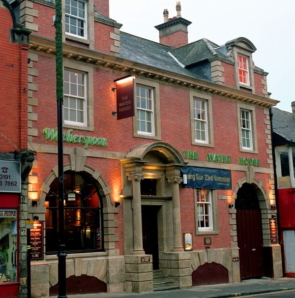
This was purpose built in Victorian times for the Weardale & Shildon Water Company and occupied (for several decades) from around 1920 by the Durham County Water Board. The Durham Water Company was established in 1849, while The Weardale & Shildon Water Company was founded in 1866. The two companies amalgamated in 1880. Most recently, the building was a branch of the Cheltenham and Gloucester Building Society and is now this Wetherspoon pub.
Prints and text about the Water House.
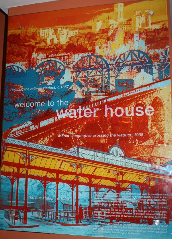
The text reads: This J.D.Wetherspoon pub here on North Road takes its name from the building’s long association with the city’s water supply. Home to the Weardale and Shildon Water Company in Victorian times, the Durham County Water Board moved in around 1920. The Water Board remained at this address for several decades.
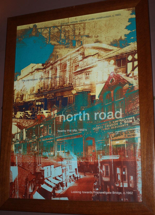
North Road was laid out in 1831 as a new route out of the city. It was originally called King’s Road, in honour of the newly crowned William IV. The long disappeared pub of that name stood a few doors from these premises.
North Road is dominated by the high-arched viaduct built by the Great Eastern Railway in 1857. The Bus Station was rebuilt in the 1970s, when part of the original ornate iron and glass passenger shelter was saved and transferred to Beamish Open Air Museum.
Prints and text about Market Place.
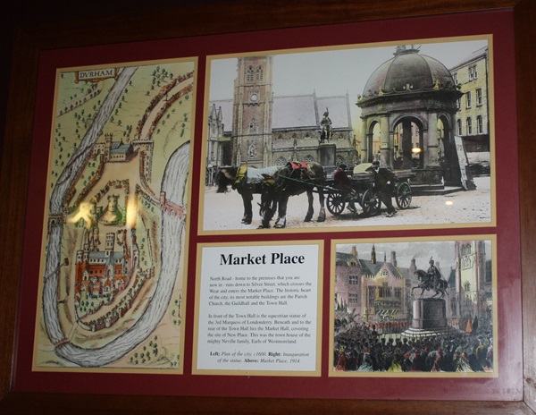
The text reads: North Road – home to the premises that you are now in – runs down to Silver Street, which crosses the Wear and enters the Market Place. The historic heart of the city, its most notable buildings are the Parish Church, the Guildhall and the Town Hall.
In front of the Town Hall is the equestrian statue of the 3rd Marquess of Londonderry. Beneath and to the rear of the Town Hall lies the Market Hall, covering the site of the New Place. This was the town house of the mighty Neville family, Earls of Westmoreland.
Left: Plan of the city, c1600
Right: Inauguration of the statue
Above: Market Place, 1914.
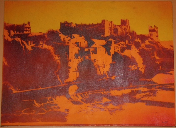
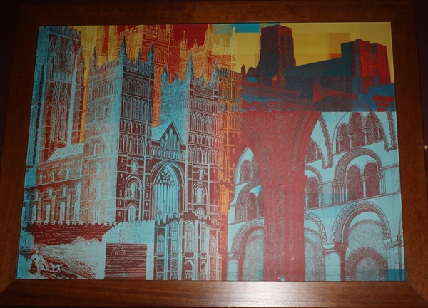
Illustrations and text about Durham Castle.
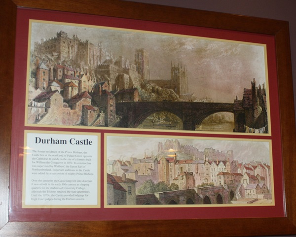
The text reads: The former residence of the Prince Bishops, the Castle lies at the north end of Palace Green opposite the Cathedral. It stands on the site of a fortress built for William the Conqueror in 1072. Its construction was supervises by Waltheof, the Saxon Earl of Northumberland. Important additions to the Castle were added by a succession of mighty Prince Bishops.
Over the centuries the Castle keep fell into disrepair. It was rebuilt in the early 19th century as sleeping quarters for the students of University College, although the Bishops retained the state apartments. Until the 1970s, the Castle provided lodgings for High Court judges during Durham assizes.
Prints of Durham Castle.
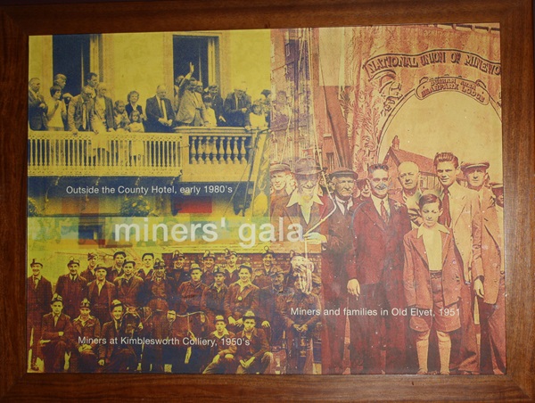
Prints and text about the coal industry.
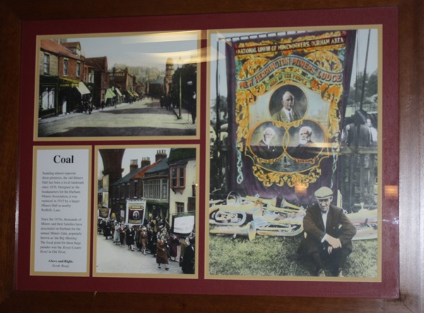
The text reads: Standing almost opposite these premises, the old Miners Hall has been a local landmark since 1876. Designed as the headquarters for the Durham Miner Association, it was replaced in 1915 by a larger Miners Hall in nearby Redhills Lane.
Since the 1870s, thousands of Miners and their families have descended on Durham for the annual Miners Gala, popularly known as ‘the Big Meeting’. The focal point for these huge parades was the Royal County Hotel in Old Elvet.
Above and right: North Road.
Prints and text about the Battle of Neville’s Cross.
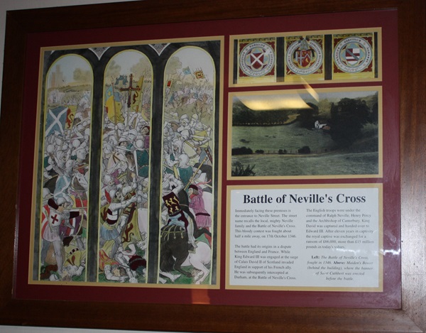
The text reads: Immediately facing these premises is the entrance to Neville Street. The street name recalls the local, mighty Neville family and the Battle of Neville’s Cross. This bloody contest was fought about half a mile away, on 17th October 1346.
The battle had its origins in a dispute between England and France. While King Edward III was engaged at the siege of Calais, Davis II of Scotland invaded England in support of his French ally. He was subsequently intercepted at Durham, at the Battle of Neville’s Cross.
The English troops were under the command of Ralph Neville, Henry Percy and the Archbishop of Canterbury. King David was captured and handed over to Edward III. After eleven years in captivity the royal captive was exchanged for a ransom of £66,000, more than £15 million in today’s value.
Left: The Battle of Neville’s Cross, fought in 1346
Above: Maiden’s Bower (behind the building), where the banner of Saint Cuthbert was erected before the battle.
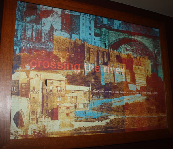
Prints referring to the crossing of the river.
Photographs of the Miners’ Gala.
Prints of North Road.
External photograph of the building – main entrance.
If you have information on the history of this pub, then we’d like you to share it with us. Please e-mail all information to: pubhistories@jdwetherspoon.co.uk